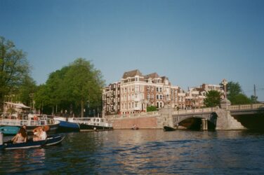
E&M‘s James Fenske takes us to Stockholm, sharing a rather unfamiliar side of the Swedish capital. Whereas the city is mostly known for its great architecture, blue lakes, Scandinavian design and fika, it is also characterized by severe segregation between its different population groups. Looking at Stockholm’s urban planning of the last decades, James tries to draw lessons for the future.
In a recent podcast interview, Swedish artist Sabina Ddumba recounts her years of commuting home to southern Stockholm. As the train pulled up at Fisksätra station, people would often instinctively make room for her to disembark, even before she indicated her intention to. You see, Fisksätra station is one of the last stops before the train arrives at its terminus in the affluent waterfront district of Saltsjöbaden, and the stark demographic differences between the two areas make it almost impossible for people to imagine that Sabina, being black, could live in the latter rather than the former.
Black and white
While Sabina also talks about occasionally skipping her stop in order to turn people’s assumptions on their heads, the fact remains that, in Stockholm, the colour of your skin largely determines where you live. This is an uncomfortable truth that challenges Sweden’s self-image of egalitarianism and ‘colour-blindness’. Despite a robust welfare system designed to reduce inequalities, our society still ends up dividing people based on ethnic background. For confirmation, one simply needs to look at the concentrations of people with foreign backgrounds in the different districts of the municipality of Stockholm. Sweden has few useful statistics on ethnicity. The best measure we have is the ‘foreign background’ metric, which counts both individuals born abroad and individuals born in Sweden with both parents born abroad. In the peripheral Rinkeby district, more than 91% of residents fit into this category, compared to less than 21% in the central district of Södermalm, only 10 km away.
The fact remains that, in Stockholm, the colour of your skin largely determines where you live
Rich and poor
While the ethnic divide may be the most visible and striking, the story of segregation can also be told in economic terms. For a variety of reasons, the ethnic and class divides have a high degree of correlation, and ethnic segregation can therefore be viewed partially as a geographic mapping of economic inequalities. The geographic segregation is particularly striking when you compare two adjacent stations on the metro’s red line, which have become symbols of Stockholm’s growing wealth gap: Mälarhöjden and Bredäng. Traveling the two minutes or so from the former to the latter, the median income drops by more than half and per-square-metre house prices drop by 60%. The proportion of the population born outside Europe also jumps six-fold from 5.8% to 34.4%.
Understanding segregation mainly as the geographic mapping of socioeconomic inequalities, it is also interesting to see how this manifests itself in the urban form. Because even here the differences are striking, as changes in urban form align quite precisely with changes in demographics. If we look at maps of the aforementioned areas and their surroundings, the stark differences materialise.
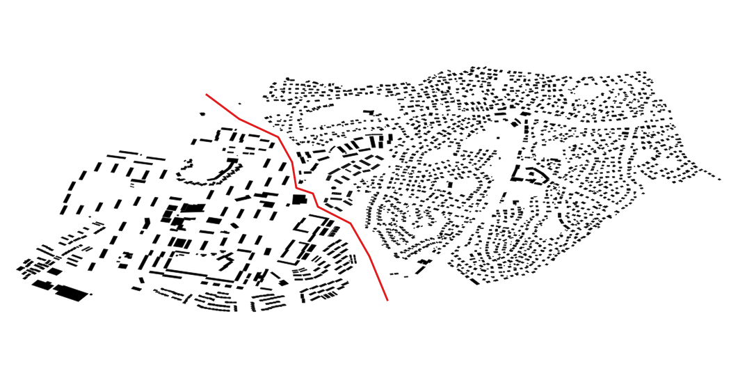

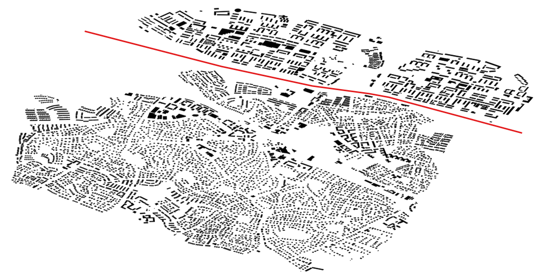
Segregation in Stockholm doesn’t fit neatly onto a centre-periphery curve – instead hotspots of ethnic diversity are scattered across the city, and often located directly adjacent to homogeneously white areas. These areas are separated by barriers that are often much easier to cross physically than conceptually, impacting how people move on a daily basis, who they interact with and what opportunities they can access in life. But how did these areas come to look so different in terms of the design and configuration of buildings, roads and public spaces? The massive ‘Million Programme’ of the 1960s is responsible for many of the distinctive forms that we see today – in Fisksätra, Bredäng, Rinkeby, Tensta and a host of other housing developments across the country.
10 years, 1 million homes
Because of this correlation between urban form and the demographic profile of an area, the Million Programme is often blamed for laying the foundations of the fragmented city that we see today. The aim of the project was to construct a million new homes in one decade, from 1965 to 1975, in a country with a population of only 8 million at the time. The project was both a response to, and a driver of, rapid urbanisation, where expanding industries required workers to move from the countryside to provide labour in the cities. With the dual goals of providing the working class with high-quality housing and providing industry with a large volume of high-performing labour, the million homes programme gave rise to a specific urban form based on standardisation, efficiency and techno-optimism.
In order to achieve the lofty goal, the national government provided funding to developers whose projects managed to maximise the number of residences per project. This resulted in large, repeated building volumes with minimal variation in form or design. They were often located on vacant land outside the major population centres, where there were fewer environmental constraints or existing residents to consider. The prevailing planning paradigm at the time also prescribed a separation of functions, meaning that the areas consisted almost exclusively of housing and a small number of services, but generally few workplaces.

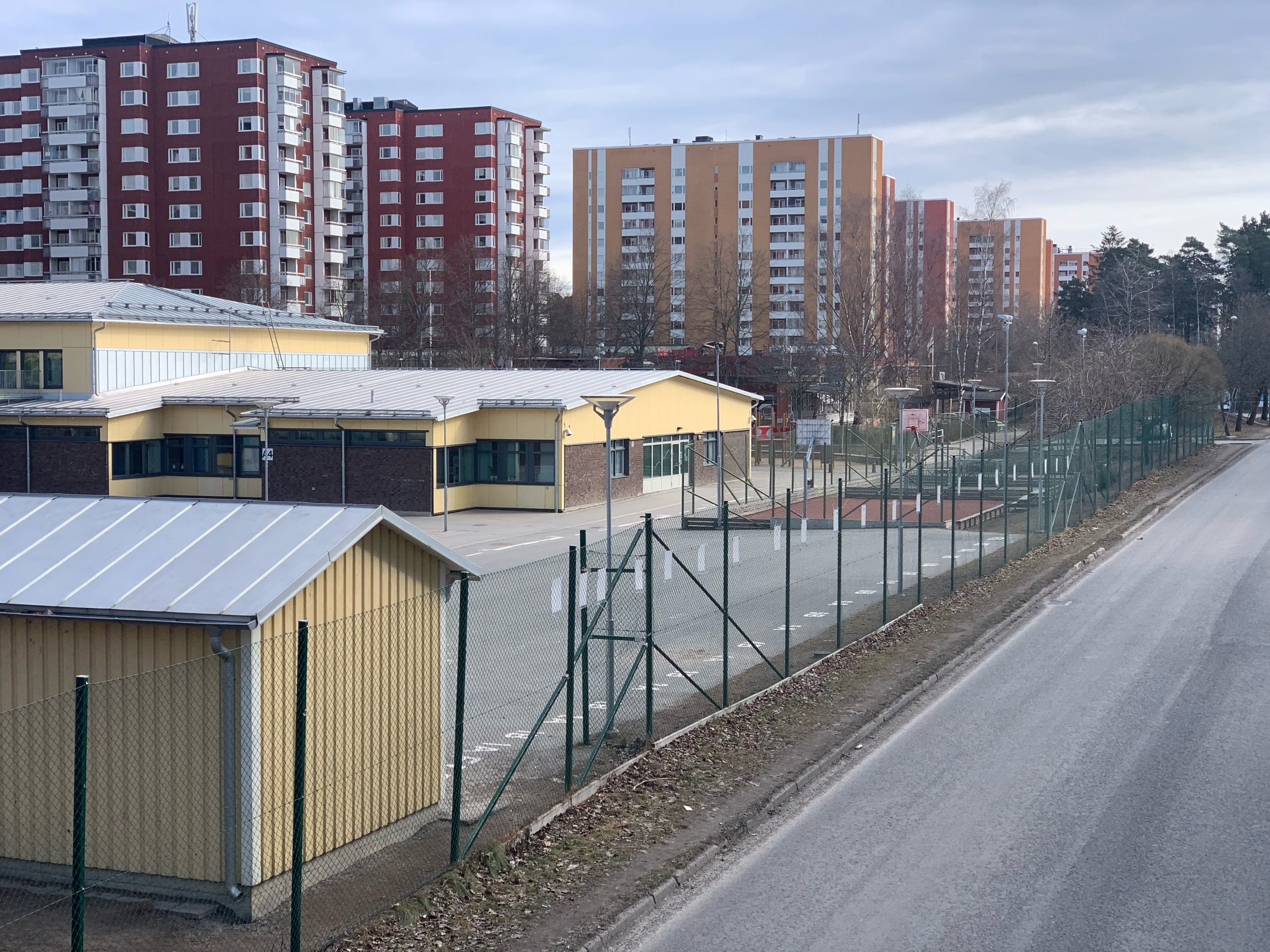
The developments were mostly well integrated with public transport, and had extensive networks of public spaces and pedestrian paths. Strict traffic separation kept playing children safely away from cars. Access to parks and nature was prioritised, and each apartment was designed to ensure sufficient exposure to daylight. The areas were meant to be desirable for both working class and middle class residents, with the goal of creating a social mix and fostering understanding between people from different walks of life.
Diverging incomes, diverging forms
But times changed, and the new urban forms that have emerged more recently seem like backlashes against the egalitarian visions of the Million Programme era. Meandering cul-de-sacs based on privatized space and ubiquitous car ownership have spread out across the landscape, filling in the gaps between Million Programme areas as the city expanded outwards. New multi-family housing developments present a kind of hyper-diverse design which flies in the face of standardisation. This has all occurred against the backdrop of neoliberal reforms that have changed the nature of housing, from a basic need to be fulfilled into a commodity to be traded. And as the urban form continues to diverge between Million Programme areas and the rest of the city, so do house prices and rents, incomes, demographic profiles and opportunities in life.
A fragmented urban landscape where the most standardised urban forms are home to the most diverse populations
Simultaneously, immigration picked up pace from the 1980s, throwing ethnicity into the mix of complex domestic political, social and economic processes already underway. Some people blame segregation purely on racism, others on cultural differences and an unwillingness to assimilate. Some see it as simply an economic or class issue, whereas others view it as a problem of urban planning and design. Whatever the causes, the results are clear – a fragmented urban landscape where the most standardised urban forms are home to the most diverse populations, and where entire areas are stigmatised while inequalities persist through generations.
The blame game
So has the utopian vision of housing equality failed? While many try to blame today’s segregation on the Million Homes programme, it is difficult to fault the planners of the day for aiming to build affordable, high-quality homes for the masses. Rather than repeatedly depicting the Million Programme areas as the problem (they are often referred to in the public debate as ‘segregated areas’), the focus must be widened: we need to problematise the entire city as segregated. The homogeneous, affluent, white areas are also part of the story of segregation. While it is a complex issue that cannot be addressed by urban planning alone, healing the scars in the urban form is one part of the solution where planners can contribute. Rather than simply focusing on ‘fixing’ Million Programme areas, energy needs to go into making exclusive areas less exclusive, and removing the physical barriers between residents inhabiting the same city.

Hope for the future
It is encouraging to see that ethnic segregation is now addressed both in the public discourse and in the way the city of Stockholm is planned. In recent years, there has been a focus on locating schools and other public services in the spaces between those adjacent areas with very different demographic profiles. This is done in the hope that at least the youth and other people using public services will interact across these boundaries. Gaps in the urban form are being filled with new development, in the hopes of creating natural pedestrian flows between different areas and making the physical boundaries less noticeable. New transit lines are being constructed to connect areas that have historically been difficult to move between.
Just like the planners of the 1960s did not envisage the effect their decisions would have on the demographic profile of the city 60 years down the line, only the future will tell if the current initiatives will be able to reduce segregation. But if they can, we might just be able to piece together our fragments of a city.
Cover photo: courtesy by James Fenske.