How well do you know Europe? Challenge your local knowledge of everything from pop to politics with these map-based puzzles: just fill in the missing key…
In 1881, an Iraqi archaeologist named Hormuzd Rassam came across an ancient stone tablet scratched with a cryptic tangle of concentric circles and lines. Baffled by its roughly scratched diagrams and unfamiliar script, he filed it away without deciphering its meaning. Only two decades later did the significance of the discovery finally become clear: it was, and remains to this day, the earliest known attempt to produce a map of the entire world.
Five and a half centuries later it is the age of Hans Rosling and big data, and maps are the ultimate infographic. It is hardly possible to visit a news site without seeing a novel representation of the world sprawled across your screen: from distributions of redheads across Europe, to the etymology of European words for ‘pineapple’.
But what happens when the key is removed? Can you, unlike Hormuzd Rassam, decipher a mysterious map? And how well do you really know Europe? Try your hand with the following four pieces of cryptic cartography:
Map 1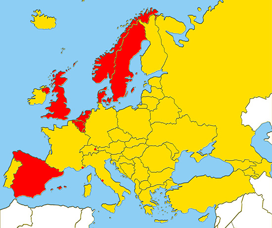
On this map, the countries coloured in crimson all have something that none of the yellow countries do. But what is it? Hint: a few hundred years ago, the whole of Europe would have been awash with red.
Map 2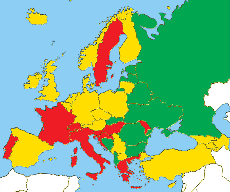
Now for something a little more difficult. It’s about a very ancient habit – a vice, some might say – which all European nations are saddled with. The colours don’t tell us how much we consume, but how we consume it…
Map 3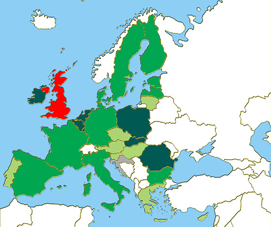
First, the easy part: what do the coloured countries (plus Croatia) have in common? And what among these countries makes the UK unique?
Map 4
The last map is the most difficult to guess, but the most fervent Europeans might be in with a chance. It involves a transnational event watched on television every year by millions – although it is ridiculed by millions more. If Israel appeared on this map, it would be coloured light green. Have you guessed what it is yet?
Answers
Map 1: The countries and dots coloured in red are the last remaining monarchies in Europe.
Map 2: The ‘vice’ is alcohol, and the colours represent which poison each country favours. Red for wine, yellow for beer and green for spirits.
Map 3: The coloured countries are of course the 28 EU member states, and the colour code reflects how each nation feels about the institution. When asked in 2011 whether membership benefits their state, all populations except Britain answered affirmatively: the darker the shade, the greater the approval.
Map 4: It’s Eurovision! Light green countries have won the song contest once or twice, darker green have three or four victories, while the darkest colours have claimed the title five times or more. Ireland leads the all-time league table with an impressive seven wins.
Cover photo: Biblioteca Nacional de España; CC BY-NC-ND 2.0 (Flickr)